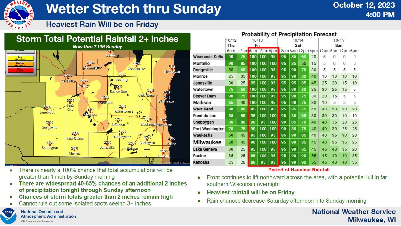
National Weather Service Forecasters in Milwaukee have made only minor changes to early Thursday forecasts, and have nearly 100% confidence in expecting greater than 1-inch rainfall totals from onset, about 4 p.m. Thursday, through 7 p.m. Sunday. And the chances of exceeding two inches was given 51% odds for Sheboygan. Odds of that increased to 65% southward to Port Washington. Forecasters also indicated that they can’t rule out isolated totals of three inches or more.
Now that rains have begun, precipitation probabilities in Sheboygan remain at 80% until 6 a.m. Friday when they rise to 90%, eventually hitting 100% by 6 p.m. Rain only abates after 6 p.m. Saturday if forecasters remain on-target, as they have been so far with this system, with more showery-type weather expected to gradually diminish before ending completely sometime late Sunday night.
——-Multiple Hazards to Deal With——-
Rain is one element, but not the only one with this storm. Winds will drive that rain into vertical surfaces, with sustained east winds increasing from 15 mph tonight, to 25 mph by Saturday night. On top of that, gusts to 35 miles an hour could be common. With many trees still holding onto their leaves, wind and rain have a much greater potential to take down branches and limbs, and that can cause outages if power lines are involved.
Mariners have their own concerns with such storms, and Gale Warnings have been posted for the southern 2/3 of the open waters of Lake Michigan from 3 p.m. Friday to 8 p.m. Saturday. East-northeast winds of 25 to 30 knots, gusting to 36 knots are expected to generate waves of between 6 and 11 feet. Small Craft Advisories are in effect until 10 a.m. Saturday for identical wind and wave hazards.